


UAVManager
(professional version)
UAVManager is an one-stop GIS eco-system for UAV data acquisition ,processing, visualization and managment, and UAV maintenance. To address a range of applications, automatic and accurate flight planning based on real 3D terrain data are integrated to UAVManager for both fixed-wing UAV and multi-motor aircrafts. Moreover, 3D real-time monitoring, fast flight quality check, versatile pre-processing toolbox,robust accuracy control and automatic mapping, 4D+ 3D outputs, visual monitoring center,and cloud services for system upgrade, smart maintenance,information pushing etc.


Simple and Reliable 3d Flight Plan
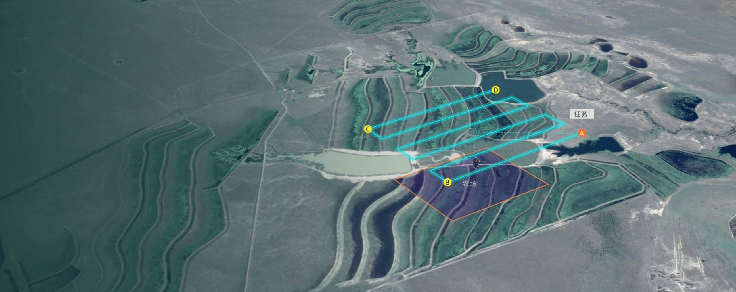
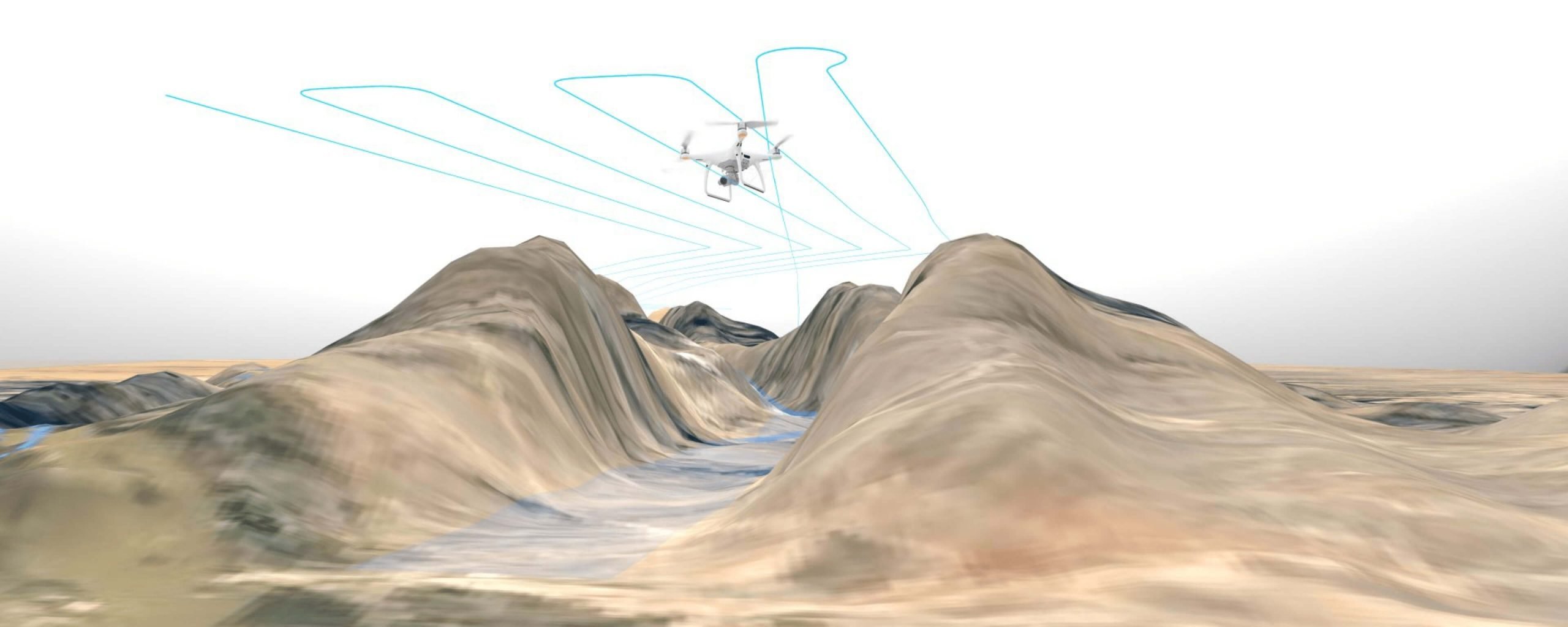
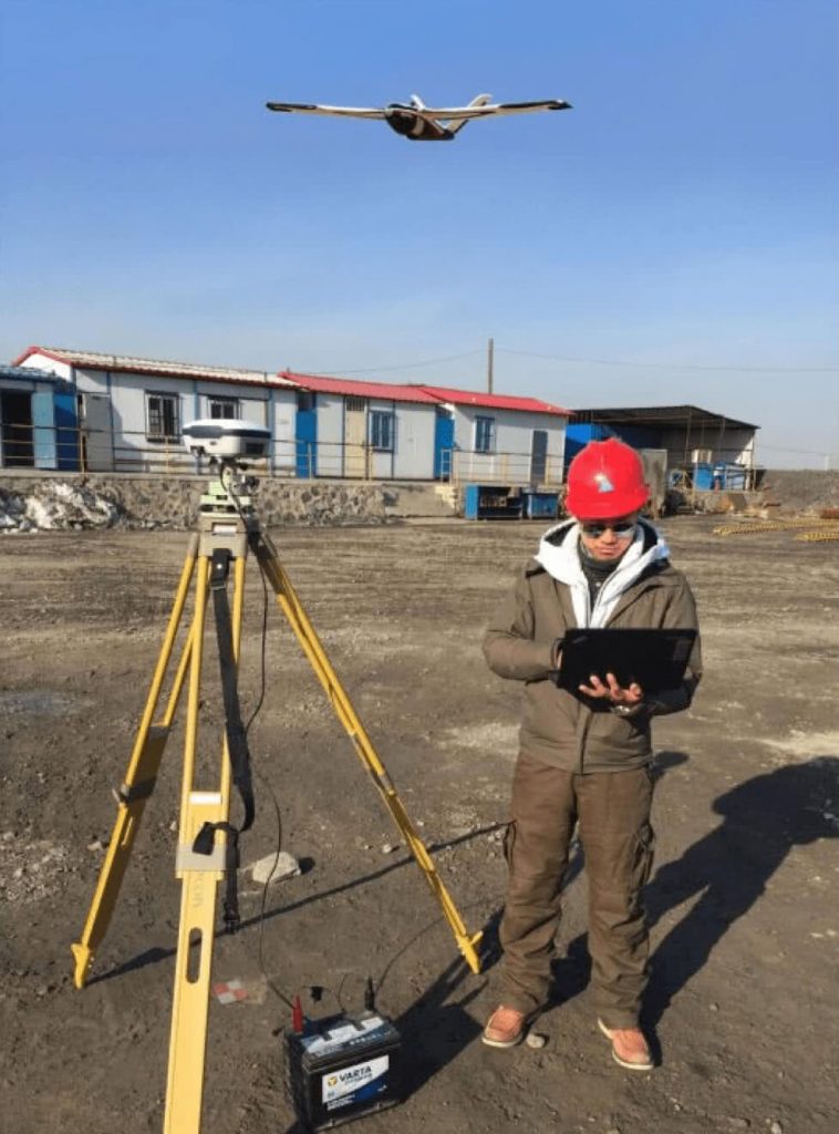
“SmartPlan” is a flight planing software for both fixed-wing and multi-rotor UAVs. According to the terrain undulation and the image acqusition requirements, accurate 3D terrain can be imported to help optimize flight plants and routes automatically. To address super large areas, automatic blocks segmentation and management for supported for boundary matching to streamline subsequent image processings.
3d Flight Plan, Making the Design Easier and More Reliable

“SmartPlan” is a flight planing software for both fixed-wing and multi-rotor UAVs. According to the terrain undulation and the image acqusition requirements, accurate 3D terrain can be imported to help optimize flight plants and routes automatically. To address super large areas, automatic blocks segmentation and management for supported for boundary matching to streamline subsequent image processings.

Software Features
- A unit interface to fixed-wing,multi-motor versatile UAVs modes, supporting different monitoring mode of shooting and video, support multi-sensor operation mode.
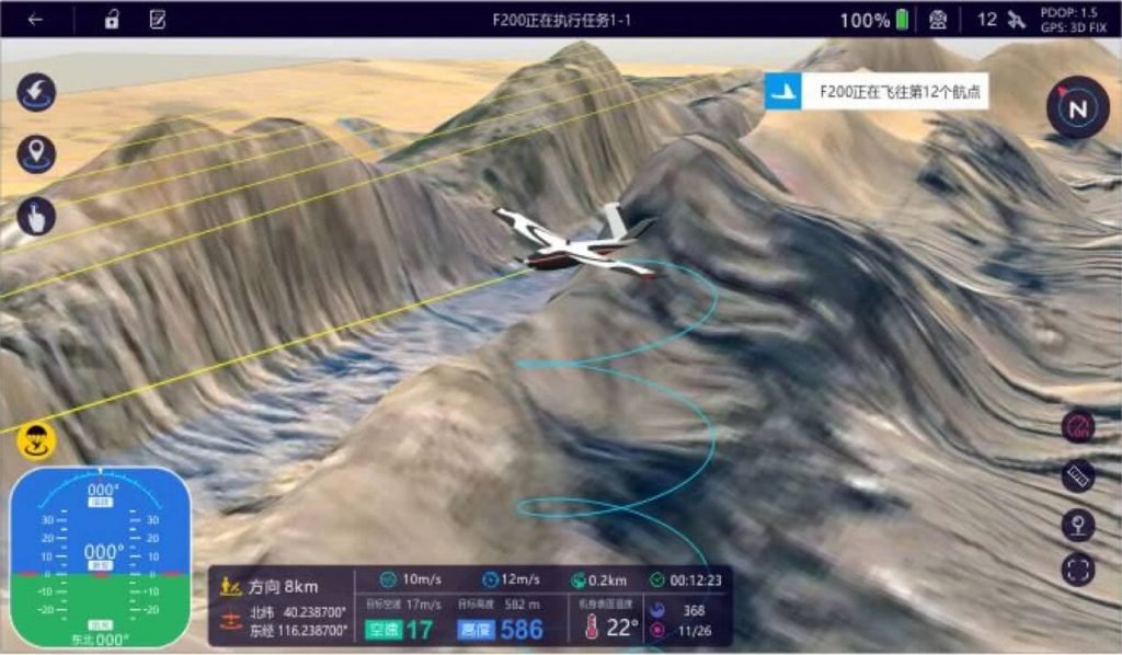
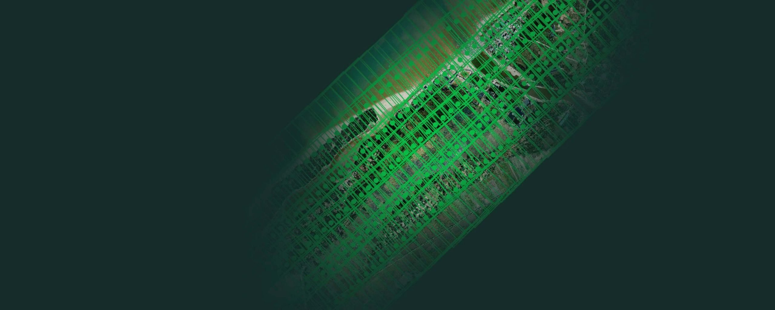
- Support 3D scenes, flight trajectory can be 3D visualized,comphrensive user monitoring information, improve the quality of monitoring.
- Real-time display of flight trajectory, flight status, wind/ground speed, battery status, aircraft temperature, and GPS status parameters.
- Uav abnormal intelligent alarm system and one-click return faction.
- Full flights playback.
- Thanks to guided interface, the beginners can easily and quickly prepare the mission.

Simple and Reliable 3d Flight Plan
“SmartPlan” is a flight planing software for both fixed-wing and multi-rotor UAVs. According to the terrain undulation and the image acqusition requirements, accurate 3D terrain can be imported to help optimize flight plants and routes automatically. To address super large areas, automatic blocks segmentation and management for supported for boundary matching to streamline subsequent image processings.
Main Features
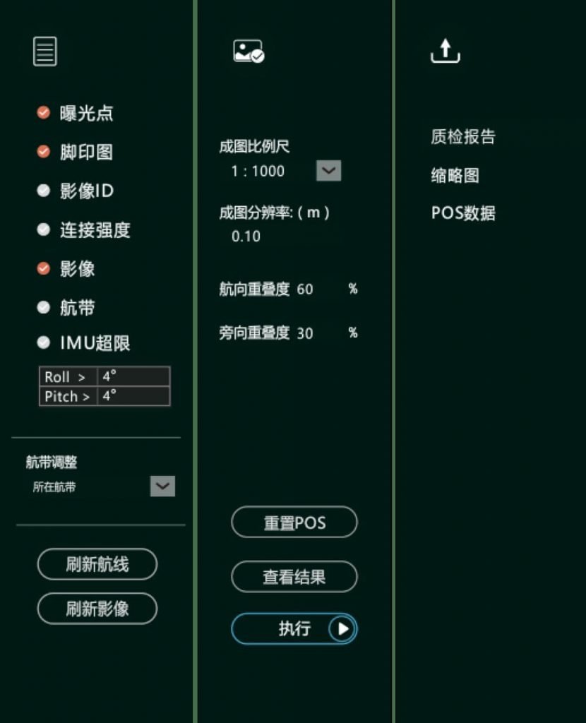
- High-automation, data quality check by one-click mode, no photogrammetry expertise required, get started with easy training.
- Based on GPU parallel processing mode, it cost 5-10mins from image importing to final report generation, helping pilots to act immediately with valuable insights.
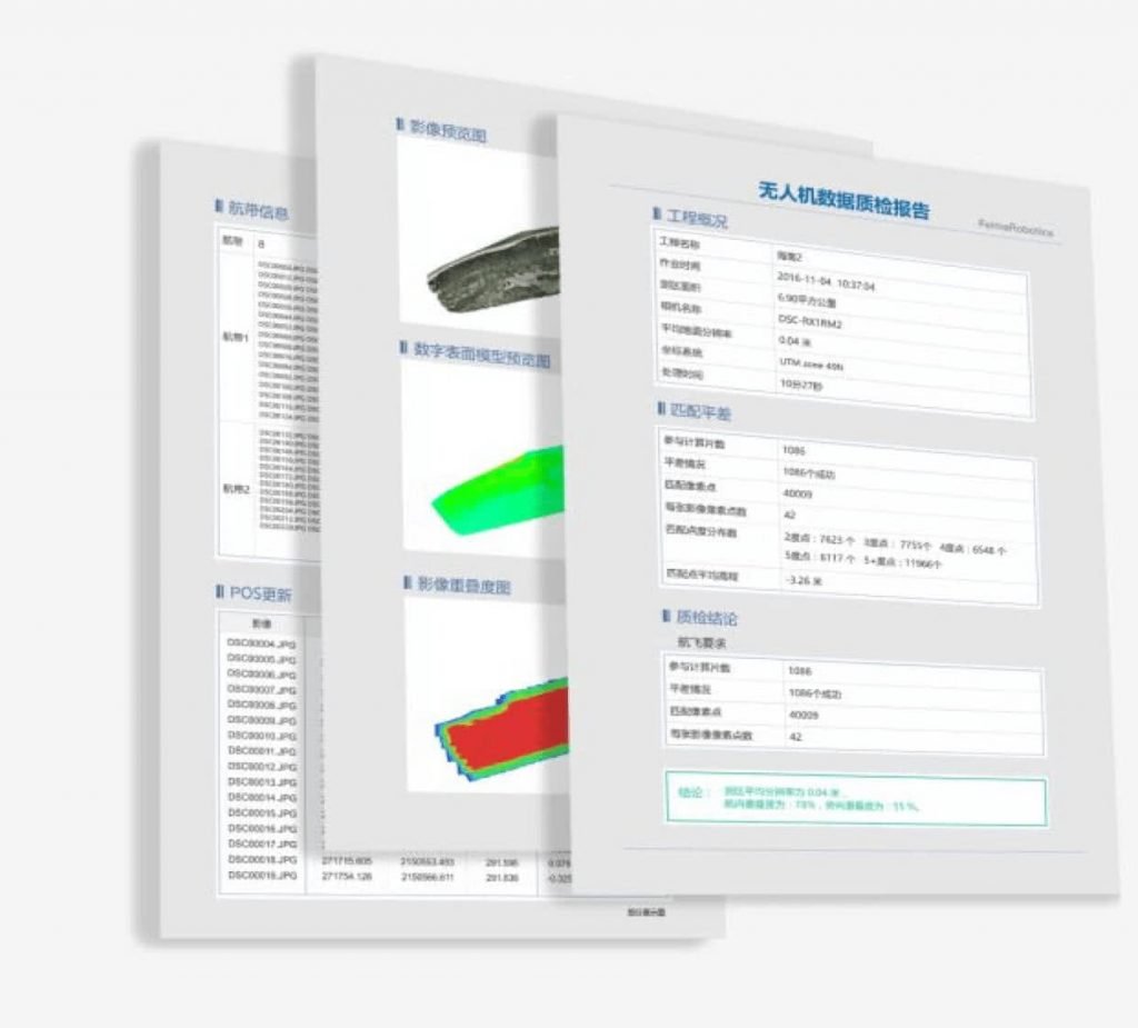
- Professional quality control report for uav data is provided. Graphic output and index statistics documents.
- It enable customers to check data quality from different dimensions, providing information, such as camera stations, footprints, attitude exceeding, image overlap intensity etc.

A Versatile UAV Data Processing Toolbox
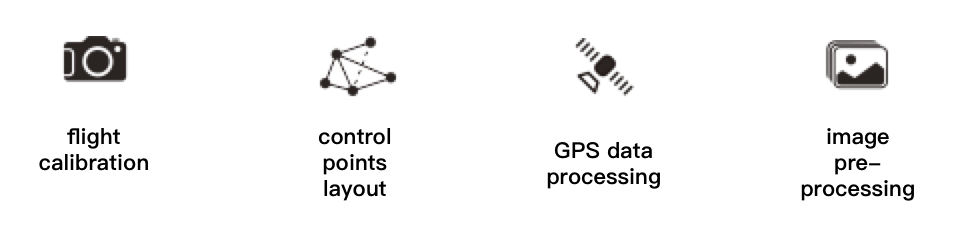
“SmartProcess” is a pre-processing software for UAV data, including advanced flight calibration, distortion correction, post differential GPS data processing, automatic and terrain-based control points layout and other tools, in order to meet the requirements of high-precision UAV surveying and mapping. Along with those, image pre-processing functions are provided, such as doging, color enhancement,image pyramid creation, format conversion etc.

High-precision, Fast and Complete Outputs Processing Software
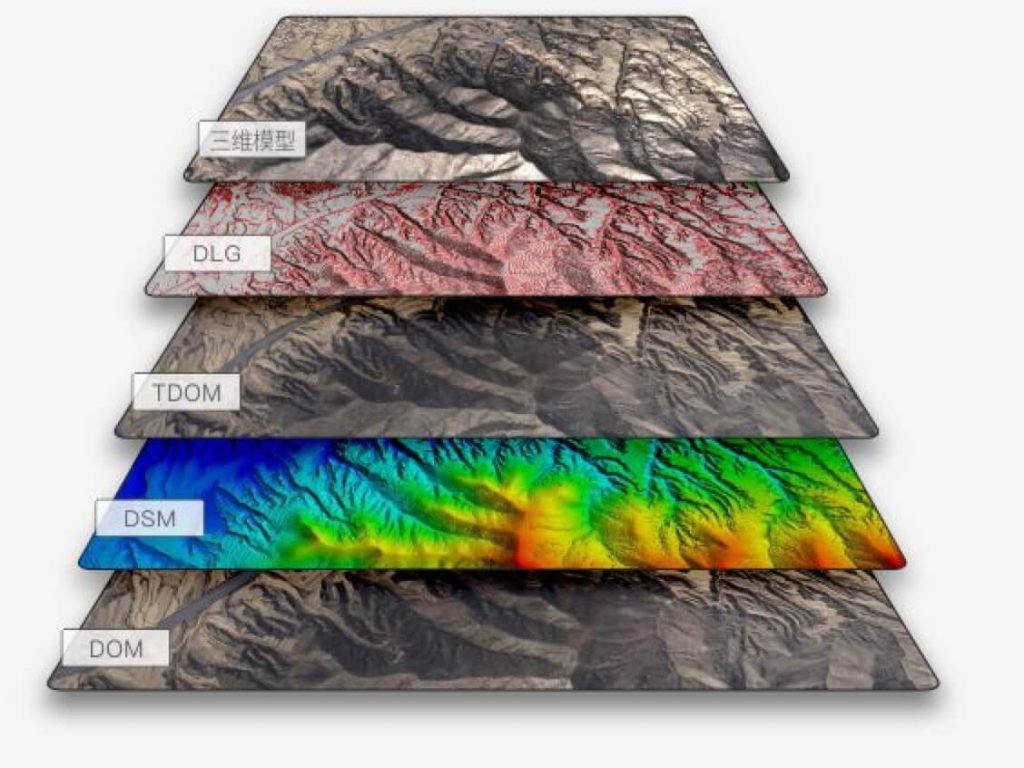
SmartMap is a one-key UAV data processing software system with its processing chain covering orthophoto and oblique-photo aerial triangulation, adaptive feature points matching, contol points measurement, ortho-rectification, color balancing, stitching, full-pixel and high-density point cloud matching, TDOM, and 3D reconstruction. Traditional DEMs and DOMs, high-precision and high-quality DSMs and TDOMs, and real scene 3D models can be generated and output by SmartMap. Intelligent control points measurements, GPS-supported aerotriangulation, PPK mode image mosaic, and fast 3D data viewing are also supported.
Software Features
- comprehensive core algorithms: it supports image matching and aerotriangulation for both vertial and oblique.It adapt to a range of situation,such as irregular image layout, great rotation, irregular overlap etc.It is compliant with image data through different cameras, terrain,weather and environment.
- Powerful processing capacity,versatile outputs: UAVManager can handle more than 10thounds image processing simultaneously, and support fast dense points cloud computation, Trueortho and realistic 3D model generation.
- Intelligent ground control points measurement, GPS supported aerotriangulation can largely reduce in-field work: UAVManager ground control measurement tool supports both manual and automatic measurement, and provides robust GPS supported aerotriagulation algorithm, ensuring the mapping accuracy desipte sparse GCPs, and improve the efficiency in UAV large-scale mapping application.
- Differential GPS based,multi-parameter aerotriangulation algorithm enables to high-precision mapping without ground controls: high-precision PPK calculation and advanced multi-parameters aerotriangulation algorithms helps to high-precision mapping, meeting the requirements for data acqusition in difficult area.
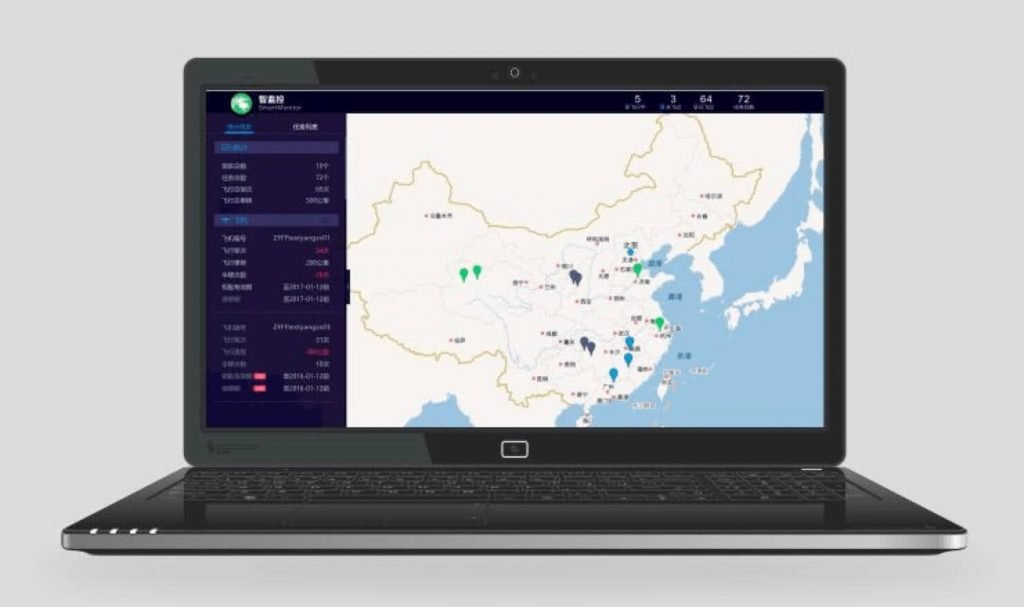

Monitor Your UAV At Any Time
“SmartMonitor” is a feature module of UAVManager, providing functions,such as visualization and review of flights,flight records analysis, dashboards.