


About E3000
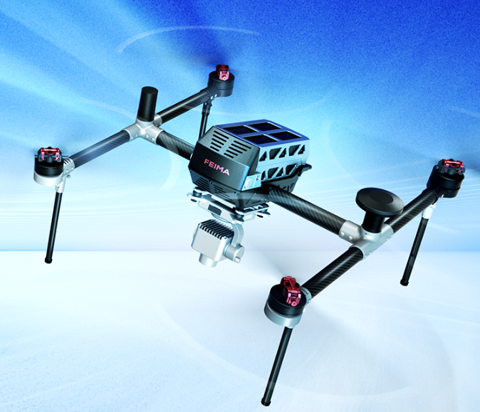
E3000 is an intelligent aerial survey unmanned aerial vehicle system developed independently by Feima Robotics. It is equipped with a mechanical global shutter and an APS-C format aerial survey module. The system features outstanding imaging quality, a variety of flight route shooting modes, autonomous imaging control, and real-time POS tagging capability, resulting in a comprehensive upgrade of the aerial survey and video application experience.
Independently developed and deeply optimized
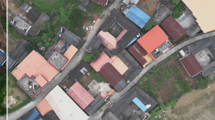
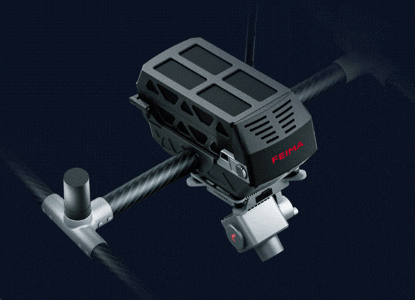
the aerial survey module utilizes an APS-C format with an image resolution of 25.2 million pixels. It supports user-adjustable ISO, white balance, and shutter speed, enabling the acquisition of high-quality aerial images in complex environments.

APS-C 25.2
million pixels
Global
mechanical shutter
Real-time
differential processing
Flight path
video recording

Mapping lens for worry-free aerial surveying
Featuring a 28mm focal length lens, the optical design adopts a dual Gauss symmetric structure and anomalous dispersion lens structure. This effectively controls the lens volume and suppresses optical system aberrations. The optical distortion of the lens is kept within 2%.
Real-time differential, concise and efficient
It can be based on real-time high-precision positioning using Network RTK, further automatically completing on-board eccentricity correction with precision. This achieves the direct integration of high-precision POS information into images. During post-processing, there is no need for POS differential processing steps, making the operation more concise and efficient.
Global shutter for precise replication
Equipped with a built-in mechanical global shutter, with a maximum speed of up to 1/2000s, it effectively avoids the jelly effect caused by exposure delay and image shift due to rapid drone movement. This greatly reduces imaging errors, allowing for the precise replication of captured scenes.


Video Functionality, Flexible Application
Equipped with video functionality, it can not only capture images of the survey area but also record videos with a fixed field of view through video flight paths.