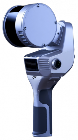


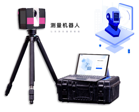
The measurement robot is a construction robot designed for quality inspection. It utilizes advanced AI measurement algorithms to process data by simulating manual measurement rules and employing virtual levels and squares to complete actual measurement tasks. The robot can perform over 300 square meters of measurement work within one hour and can automatically generate reports. Its measurement results are more objective and accurate compared to manual methods.
| Advantages | |
|---|---|
| High Efficiency | Automation of Measurement Processes |
| High Accuracy | High-Precision Imaging and Image Processing |
| Intelligent Automation | AI Measurement Algorithms and Automated Reporting |
| Parameters & Key Indicators | |
| Model | BZL-CE02-A |
| Accessories | Tripod / Scanner / Computing Terminal |
| Dimensions | 300x183x103mm |
| Work Efficiency | >300㎡/h &2 Minutes per Room |
Industry Status
Actual Measurement and Testing
Based on national or industry-specific quality acceptance standards, it is used to provide project managers with accurate feedback on product quality, enabling them to take timely measures to eliminate critical issues or improve construction techniques.
Problems with Traditional Processes
- Measurement tasks are extensive and complicated, requiring the use of numerous measurement tools, which is time-consuming, labor-intensive, and inefficient.
- Relying on relatively outdated data collection methods such as spirit levels and feeler gauges, the number of data points collected is limited, the sampling rate is low, and the results are easily influenced by the measuring tools and human operation.
- The measurement results are manually compiled, leading to fragmented data that is difficult to maintain and lacks objectivity. This makes it challenging for project management to detect issues in a timely manner and to carry out accurate and comprehensive quality control of the construction.


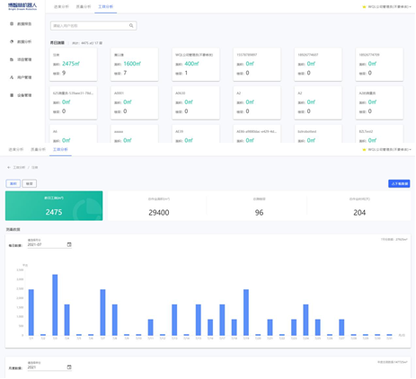
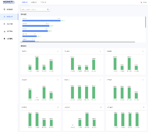
Cloud Data Management
Supports measurement data quality analysis, measurement progress analysis, and efficiency analysis; facilitates role and permission management for project personnel and equipment management.

Relative Items
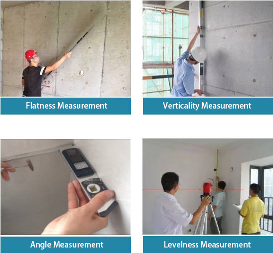
Wall Flatness, Verticality, Squareness, Corners, Ceiling Levelness, Floor Levelness, Ceiling Flatness, Floor Flatness, Room Depth Variation

Construction Phases
Supports stages and elements such as concrete structures, high-precision blocks/walls, plastering, civil engineering handover, renovation, and unit acceptance.

Task Management
Supports management of construction project floor plans, standard library management, site type management, and more.

Data Report Management
Supports real-time generation of visual data reports, including heatmap displays for underperforming areas.
AI Intelligent Algorithms
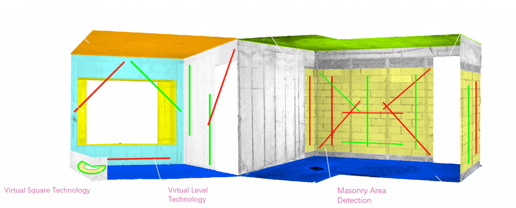
AI Intelligent Algorithm Recognition: Automatically identifies building elements such as walls, doors, windows, ceilings, and masonry.
Precise Virtual Level and Square Technologies: Replace traditional measuring tools, offering faster and more accurate measurements.
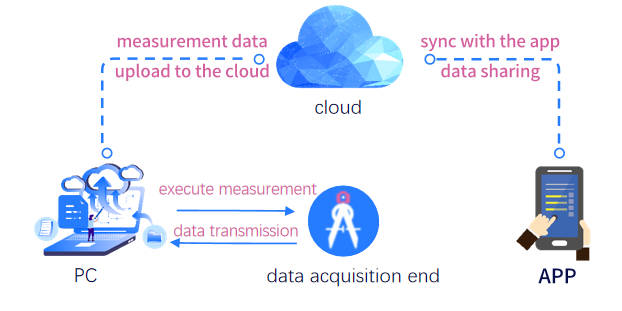
Information-Based Process Management
Real-time calculations on-site, with measurement data uploaded to the cloud backend system for centralized management. Strict permission controls are applied for data sharing to the app.
Multi-Party Collaborative Quality Management
Role classification and permission levels are established based on different roles to facilitate multi-party collaborative management, ensuring that data from a single measurement can be utilized by multiple parties.

intelligent analysis of measurement data
Progress analysis
You can view the current construction measurement progress and work areas for the project, each construction stage of the project, buildings, each construction stage of the buildings, and data such as the number of measured floors.
Quality analysis
The overall pass rate for project measurements, pass rates for each measurement item, and comprehensive measurement data from the project level down to buildings, floors, unit types, and stations are all fully presented.
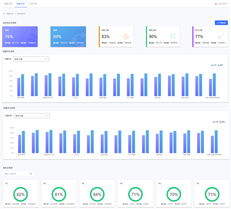
Work efficiency analysis
The surveyor’s work details, including accumulated work area, floors measured, and number of working days, are clearly presented daily, monthly, and yearly, with data trends and traceability.