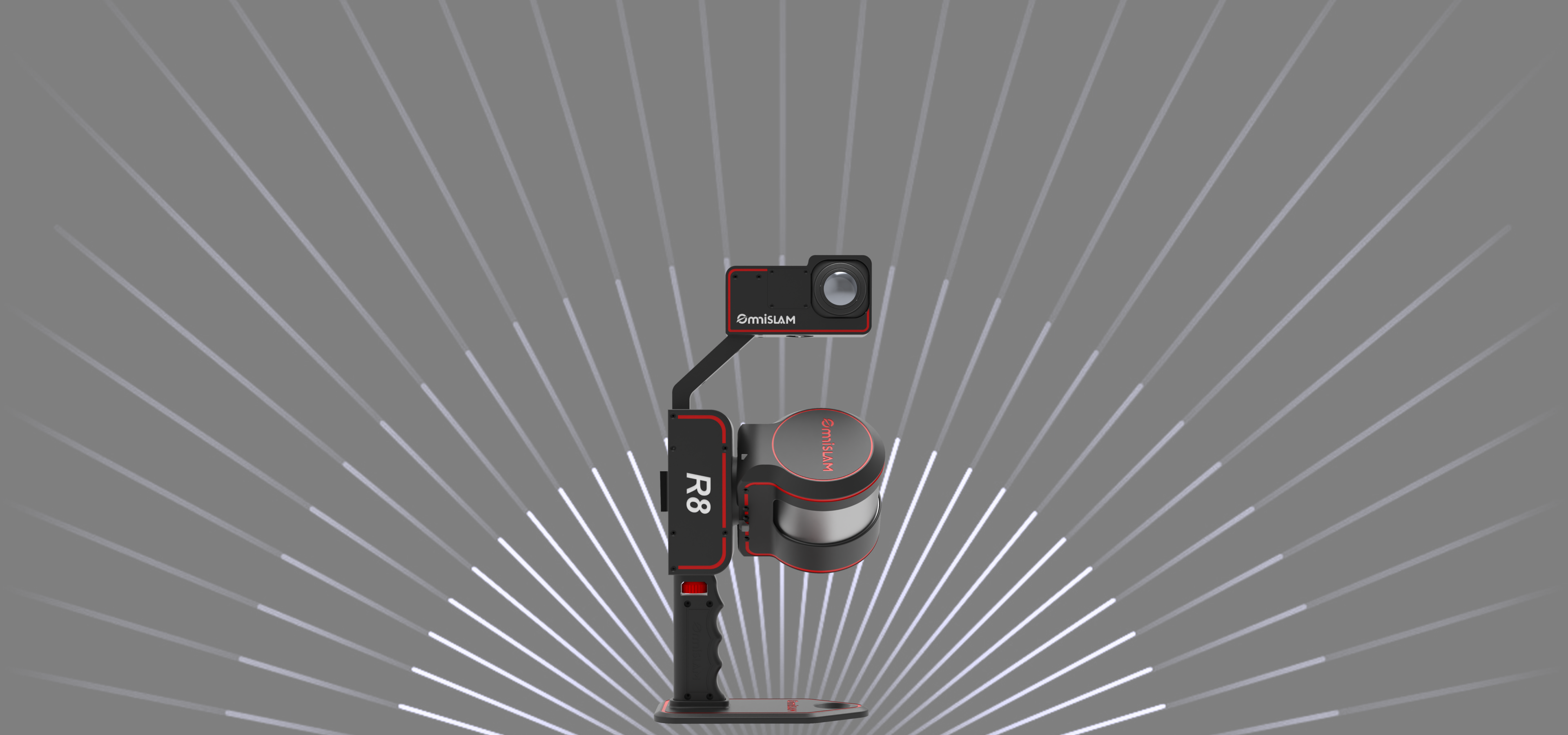
R8
Precision Level (cm)
Surveying & Mapping | Rotating Single Lidar
Rotating Single Lidar Scanner
1cm
Relative Accuracy
Horizontal 1.8cm
Vertical 2.5cm
0.015°
Horizontal/Vertical Accuracy Error
1cm
Point Cloud Thickness
10,000pt/m²
Point Cloud Density
2cm
Repeatability Accuracy
R8
meets 5A-Criterion of
Surveying and Mapping
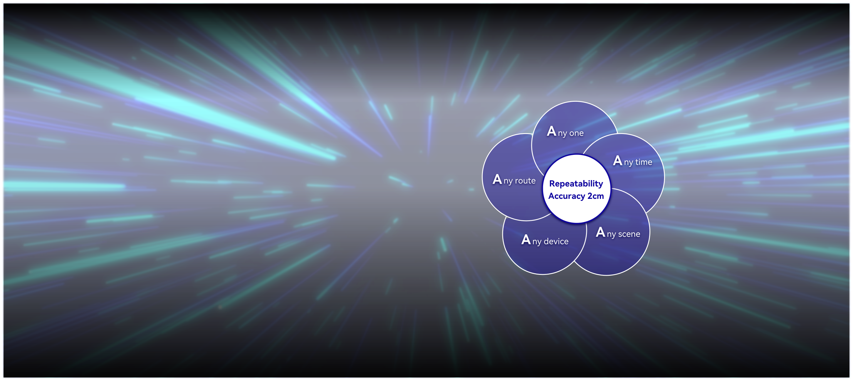
In the geospatial industry, any scene is scanned by Anyone in Any
route with Any device at Any time, the UNIQUE point clouds should
be acquired theoretically.
Repeatability Accuracy
R8 meets the strict 5A criteria for surveying and mapping. The repeatability accuracy of the point clouds in WGS84 or local coordinates is within 2 cm by repeatedly scanning.
R8
Repeatability accuracy of twice works
The dual screen linkage between panoramic image and color point clouds
R8 has dual screen function of panoramic image and color point clouds, so that users can view the same scene features simultaneously.
OmniSLAM™ PPK-SLAM
Tightly Coupled Complementary Filtering Algorithm
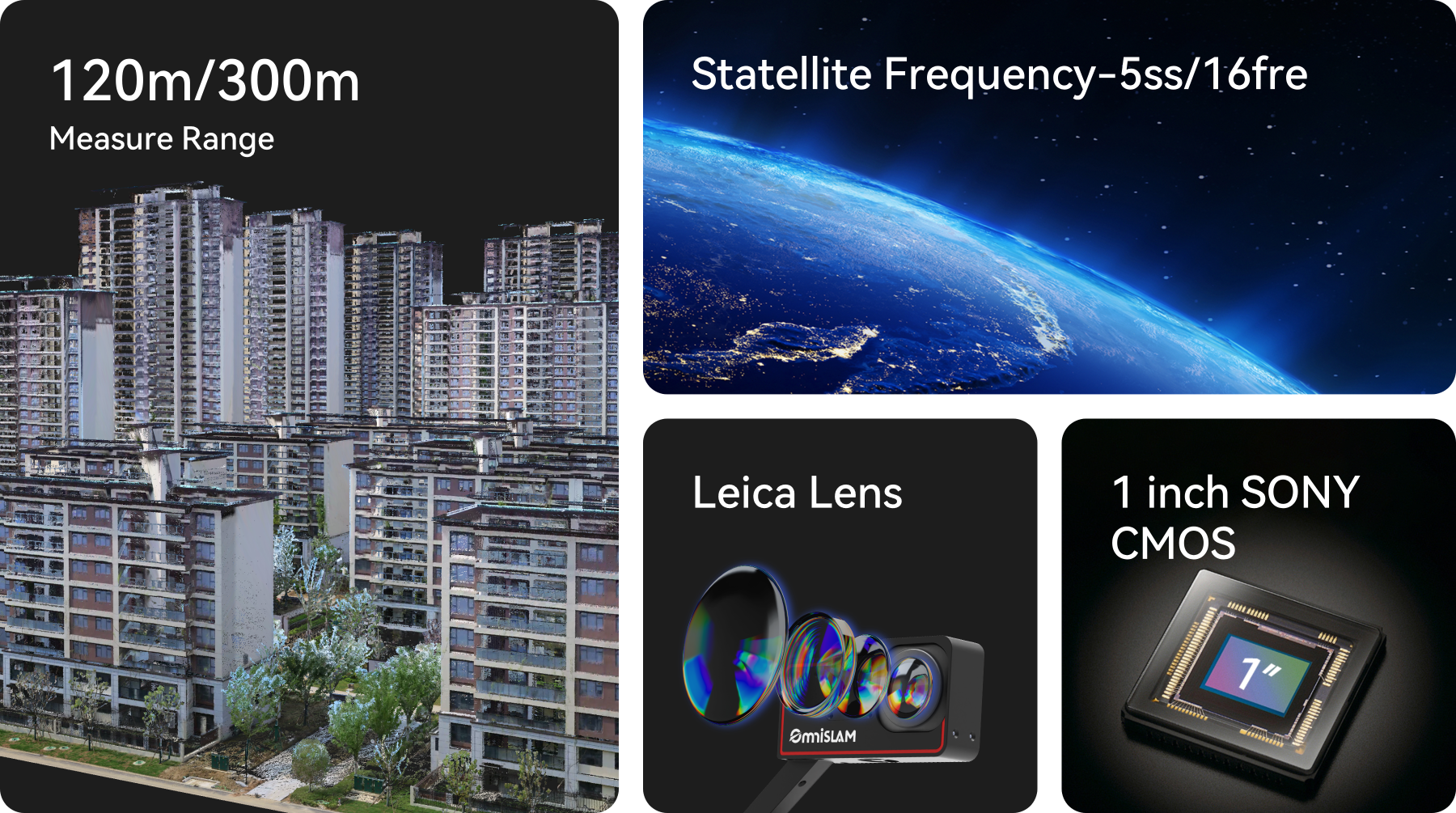
In the case of weak RTK signal quality, Misleading GNSS Fix may occur, which leads to the wrong point clouds. OmniSLAM™ PPK-SLAM, an innovative type of Tightly Coupled Complementary Filtering Algorithm independently developed by OmniSLAM™, which is able to maintain accurate fixed solutions. Even in challenging environments, it can still acquire the WGS84 point clouds of 1:500 accuracy.
“Horizontal & Vertical” of Point Clouds
The Mobile SLAM Color 3D Laser Scanner can generate absolute horizontal and vertical WGS84 point clouds. The horizontal and vertical accuracy error is within 0.015°.
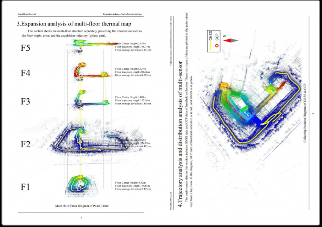
Accuracy Report
OmniSLAM™ Mapper generates an Accuracy Report, which provides the Mean Value of Absolute Deviation(MVAD) of point clouds for each scan and the 3D thermal map of point cloud accuracy.
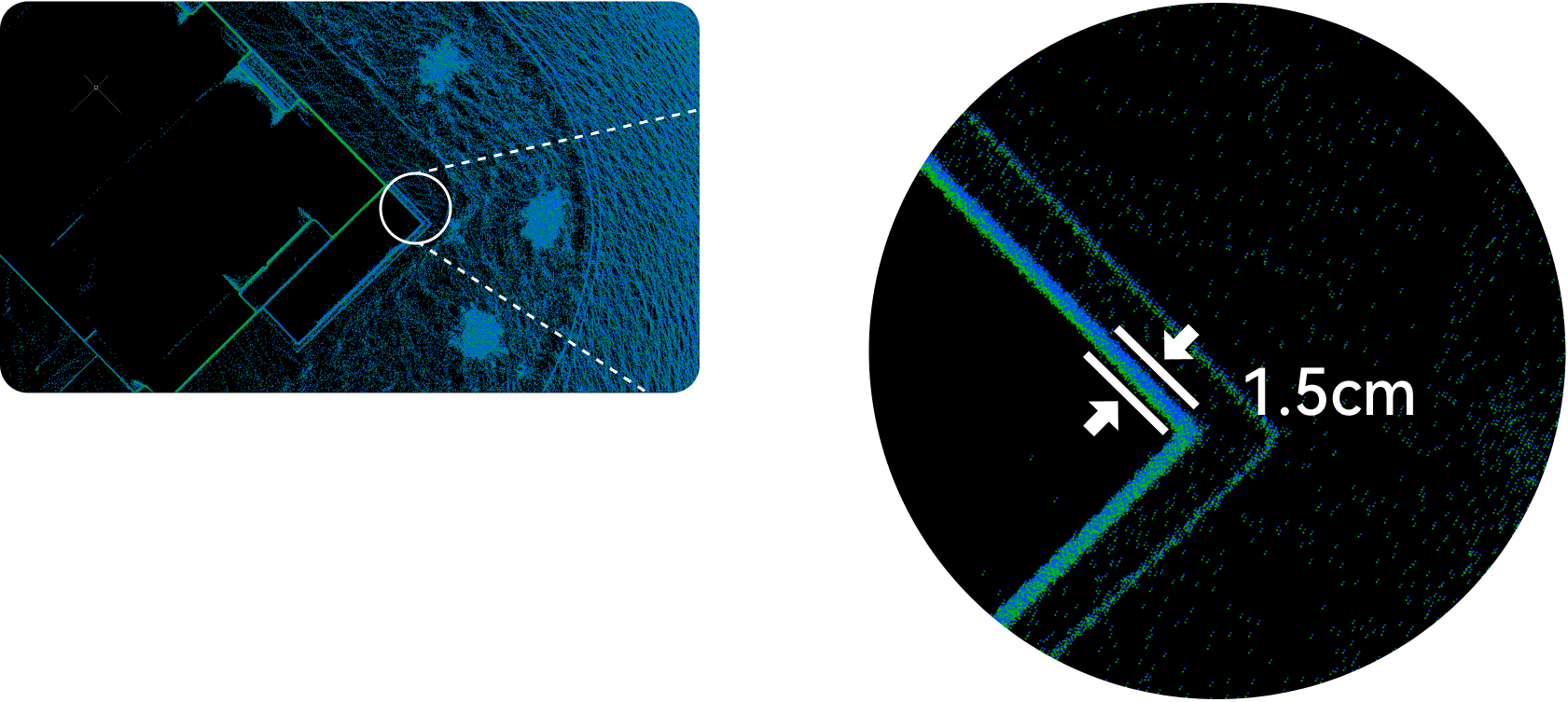
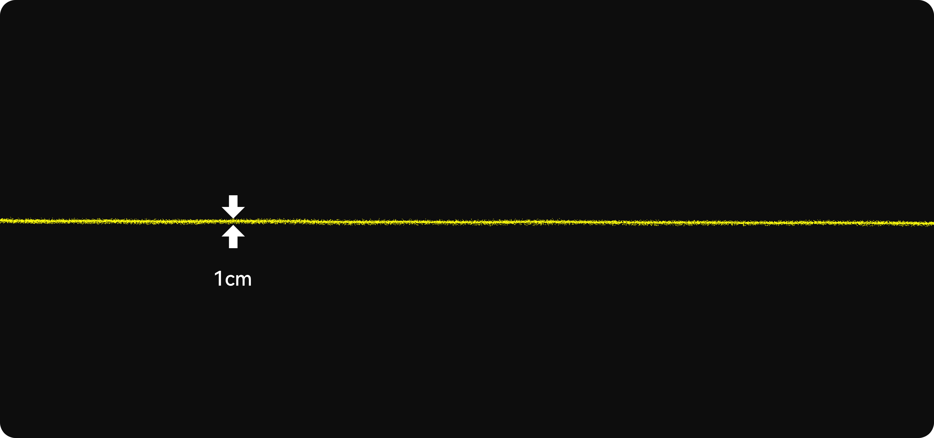
“Detailed”
Carving of Point Clouds
R8 obtains the thickness of unfiltered point clouds is 1cm with real edge and clear text.
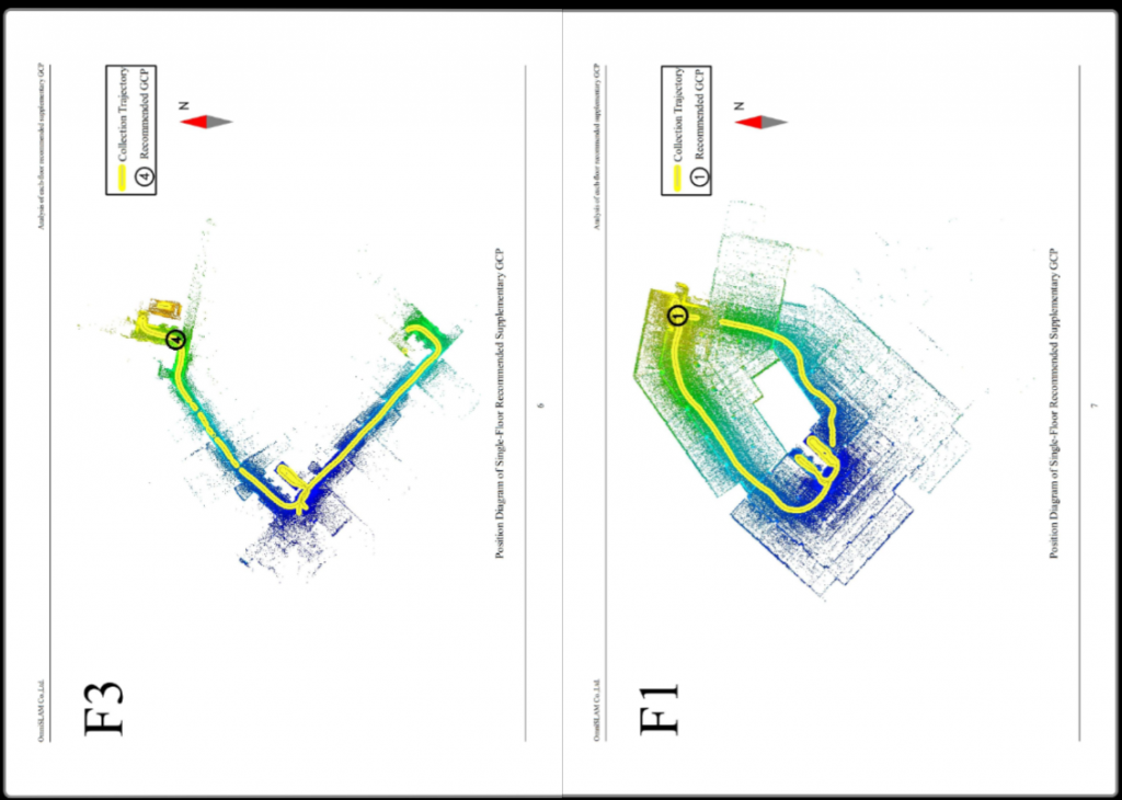
GCP Inserting Instruction
The Mobile SLAM Color 3D Laser Scanner of OmniSLAM™ generates a GCP Inserting Instruction. * For the point clouds of unsatisfied accuracy of a certain scan, the instruction will suggest the quantity and position of GCP for generating efficiently.