


Application Scenarios of Slam100
The Feima Slam100 handheld mobile 3D laser scanner can start from unknown environments and unknown locations. It can simultaneously perform positioning, acquire spatial 3D data, and construct incremental maps of the surrounding environment even in the absence of GPS and lighting conditions. It is suitable for various underground space applications such as underground garages, civil defense projects, subway tunnels, municipal underground pipeline corridors, and underground warehouses.
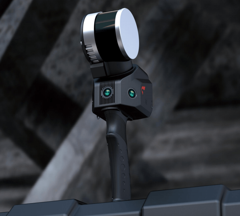
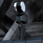
Feima slam 100
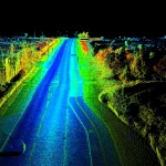
Terrain Surveying: Traditional terrain surveying, deformation analysis based on topographic maps, landslide detection, disaster response, volume calculation for earthworks, and other applications.
Real Estate Surveying: Integrated real estate management, cadastral surveying, digital collection of housing data, small-scale real estate surveying in specific areas, and other applications.
Volume Calculation: Calculation of volumes for small areas such as indoor and outdoor grain piles, coal piles, and other materials.
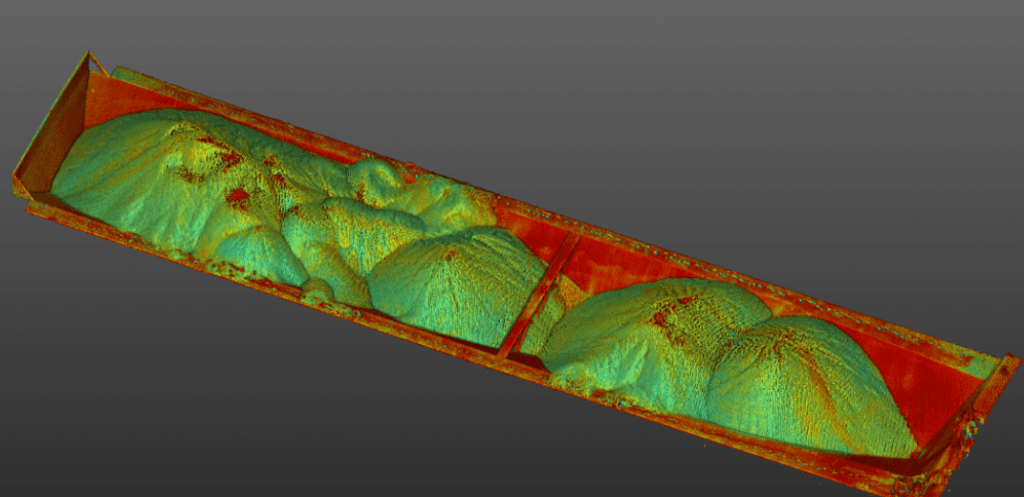
Calculation of volume of sand carrier
Underground Spaces: Measurement of artificial enclosed spaces such as underground garages, tunnels, and subways,underground parking lot, applicable for closed space inspection, intelligent navigation, and base map utilization.
Caves,Mines and Tunnels: Exploration of natural caves, tunnels, urban underground corridors, and channel-type environments, as well as emergency rescue based on them.
Volume Measurement: Measurement of volume for large enclosed containers such as oil tanks, grain silos, and others.
Heritage Preservation: 3D scanning and modeling of ancient buildings, tombs, large-scale spatial structures requiring archival protection, sculptures, ancient trees, and others.

Heritage cloud point
Digital Management: Digital factories, indoor navigation, Building Information Modeling (BIM) applications, line patrol and inspection, and other digital management applications.
Reverse Engineering: Scanning and modeling of both internal and external areas of large objects such as aircraft, ships, and large vehicles, used for reverse engineering and other applications.
Completion Surveying: Surveying upon completion of large-scale construction projects, including buildings, industrial areas, residential areas, subways, and others.
Forestry Survey: Monocular extraction and segmentation, tree quantity and diameter at breast height statistics.
Facade Measurement: Scanning and modeling of building facades for renovation projects in both domestic and international old communities.